Amateur Radio Direction Finding
These days Amateur Radio is more like a sport than a hobby. There are so many out-door events and contests to get involved in like Summits On The Air, the National Parks Award and Amateur Radio Field Day Contests etc. But what could be more fun than combining Amateur Radio with orienteering? It is called Amateur Radio Direction Finding (ARDF). The concept is simple: Someone hides a small transmitter and you try to find it by tracking down its “beep, beep, beep” signal using a tracker.
Introduction
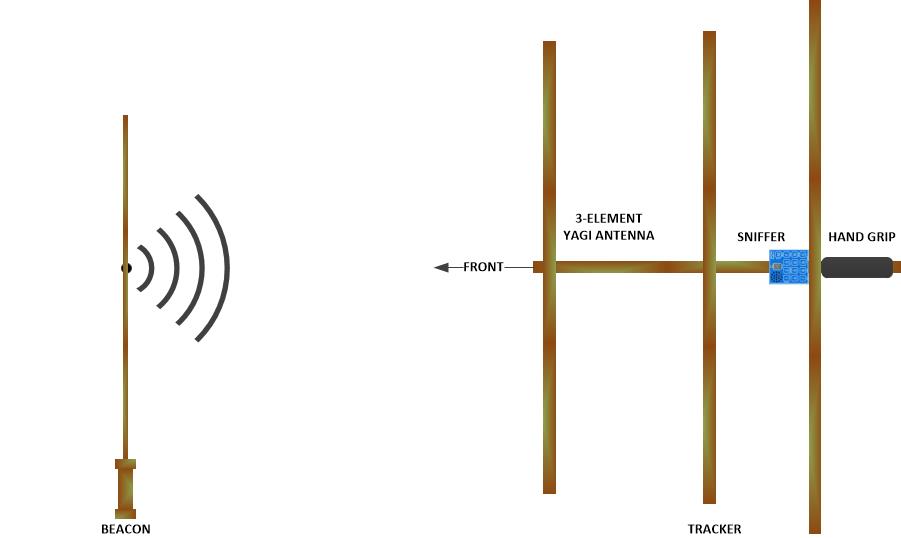
The transmitter is called a beacon (Note that ARDF used to be called "fox hunting" and the beacon used to be called a "fox"). The beacon emits a weak radio signal. The tracker is a directional antenna and receiver used to find the direction of the beacon.

The tracker looks like a small TV antenna with a little box called a “sniffer”. The sniffer lets you hear the beacon’s signal and determine the direction of the beacon from your current location. You can follow the tracker to the beacon or you can take bearings and triangulate the beacon. To triangulate the beacon you plot the direction (or bearing) of the beacon at your current location on a map. You repeat the process at two other places sufficiently far apart so that the three bearing lines plotted on the map form a triangle around the predicted location of the beacon.
To plot bearing lines on a map you could:
- Draw your own map of the school playground or print out a Google Earth satellite view of the school buildings, trees and playground etc.
- Laminate the map so you can draw on it using felt-tip pens.
- Plot your current position on the map. Look along the tracker bearing for a landmark (a tree or building). Locate the landmark on the map and plot the position of the landmark. Then draw a straight line between the two points using a ruler and felt-tip pens.
- Use a compass to get a bearing to the beacon. Orient the map to magnetic North and use the compass again to plot the bearing line on the map.
- Download and use a free triangulation app on a smartphone. Point phone in the same direction as the tracker. Press the button on the app and it uses the phone's internal compass to plot a line on the map.

Preparation
- Create and laminate a map. Get felt-tips pens and a ruler. Or download a smartphone triangulation app.
- Connect the beacon battery. Check that it is working with the sniffer.
- Hide the beacon somewhere in the school playground. Put it in a high place so it is not tampered with.
- Determine three check-points along a trail in the playground in different directions from the beacon.
- Assemble the group in a clear area away from the beacon.
- Demonstrate how the tracker works and give each member in the group a turn.
Activity
- Hold the rear end of the tracker by the hand grip with the elements pointing up and down.
- Observe the number displayed on the sniffer (0 – 9) and listen to the pitch of the tone from the speaker as you move the tracker around.
- Turn in a complete circle: The highest number displayed together with the highest tone pitch indicates that the tracker is pointing towards the beacon. The number increases as you get closer to the beacon and the tone is reset to a lower pitch each time the number increases.
- Move the tracker slowly from left to right and back again in the general direction of the beacon.
- Note where the tracker is pointing for the highest number and pitch. Use landmarks or take a compass bearing and draw a line from your position in that direction on a map.
- Move along the designated trail to a different position and let someone else get a bearing for the map. At the end of the trail your map will show where the plane is and you can complete your mission.
Tips: Have Fun! But don’t run and don’t poke anyone in the eye with the antenna elements. Be aware of false readings caused by reflections from nearby metal structures.


Homework
- Learn about compass bearings, maps and magnetic/true North.
- Use a compass to plot bearings on a map.

